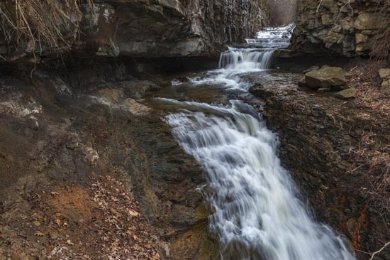
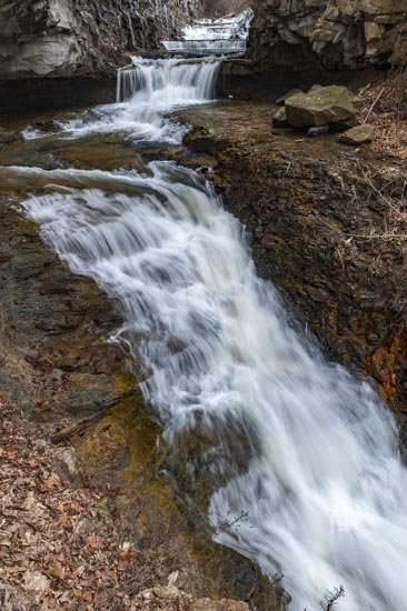
39.613125, -79.962447

39°36'47.3"N 79°57'44.8"W

GPS coordinates are for the parking area at the kiosk.  Take Exit 1 on I-68 and turn north onto US 119. Drive 2.4 miles and turn right on Callen Ave. Take an immediate right on Mississippi St. and go just under .5 mile to a kiosk and parking. Cross the street and follow the "Woodland Trail" along the reservoir. The falls is at a spill way at the dam at the end of the reservoir. Access is not too hard, but you should be careful as some of the perches for photography are dubious at best.

Coburn Creek1

Coburn Creek2

White Park Dam 12624

Site Search

Submit Falls

If you know a waterfall
not reviewed here you
may submit it here.
Please try to include
GPS Coordinates.

Click to fill out form.

Waterfall Trail

West Virginia Waterfalls
Trail p
resented by Dept
of Tourism.
Completing
trail makes you
eligible
for prizes. (MORE INFO)

Weather

WVNS_Map.png

Copyright

Copyright 2010-2023
Nature Trek Publishing, LLC

5979 Wind St.
Cincinnati, Ohio 45227
513-555-1212