39.591670, -79.758970
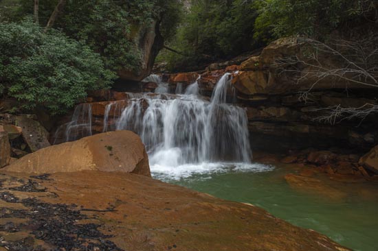
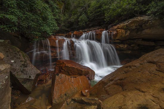
Matador is one that I have had on my bucket list for a number of years and I don't know why it took me so long to get there, but it did. So you can imagine my gratification at finally finding and photographing this wonderful place. It is located east of Masontown on Bull Run Rd. That alone should be enough to get the intrepid waterfaller there, but I will tell you more.
The GPS is a guess, but I believe it to be fairly accurate. At any rate, if you get on Bull Run Rd, you will find it. From WV7 (Main St.) in downtown Masontown, turn east onto E. Depot Way (at the liquor store/ Main Pharmacy) which turns into Herring Rd. and follow for about 1 mile. Turn left onto Bull Run Rd. for about 3.2 miles to the end of the pavement. From there, it's about one mile to a fork in the road. Stay to the left on Bull Run Rd. and drive about another 0.1 miles to a place to park. Looking down into the creek, you should be able to see the falls from the road. It's a long way down, but you should be able to see them if the water is running.
You will see a space that looks like a vehicle may have gone down into the gorge and there may be a water trail leading down to the creek. Follow that down. It's not too bad untill the last, so be careful. When you get down there, you will see.
There are several big rocks to perch on and they will also be in your forground for photos, but so it is. Unless you can get in the water, that's just how it is.
I would also tell you that this space is a hotbed of trillium and trout lilly. Our visit was mid April and there were so many trout lilly leaves coming out of the ground it was hard to know where to step with out killing one. The trillium were not far behind in abundance, and were in bloom. Both are just totally covering the hillside on the way down to the falls.
Another thing you need to know is that this is a favorite place for ATV riders and they do come and go from here to the river. Also, if you don't have a high clearance vehicle, I wouldn't venture past the place where the falls are.


