39.3745989, -79.7051119
39°22'28.6"N 79°42'18.4"W
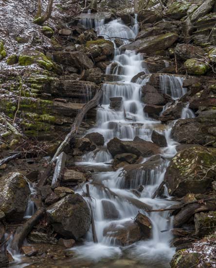
This isn't really Tunnelton. It's Buckhorn Run. Buckhorn Run Waterfall.
I just called it that because it seemed to fit at the time and the town of Tunnelton is just up on top of the mountain from here. I believe that the waterfall's source is from somewhere in the towns vicinity and is probably a drainage from up on the mountain.
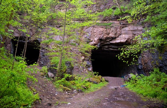
Drive 2.9 miles north of Rowelsburg, W.V. on WV 72 to a pull off with two tunnel entrances facing the road. They are less than 50 yards off the road and very visible as you drive along. The waterfall is about 60 – 80 ft. tall slide just to the right side of the tunnels. If you walk uphill along this drainage, you will see that this is an extremely tall sectioned fall with a really tall drop at the top. The only problem is getting to it and getting a photograph may be next to impossible with out a lot of fallen timber in the shot. Have a look.