38.138712, -81.203446
38°08'19.4"N 81°12'12.4"W
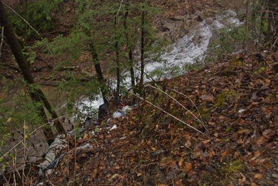
My inaugural adventure up Falls Creek on Deepwater-Cotton Hill Rd. was less than stellar, though quite interesting and informative. It seems there is a pretty nice and large waterfall very near the bottom of the run, which I would probably consider worth photographing, if I could get to it. It's about a 30'-40' drop and in a pretty dangerous little gorge (as seen from the top) and it was also not the best conditions for us, with lots of rain and mud. This is not your family sedan friendly road. The location is further complicated by the amount of garbage dumped here. Too bad.
From the Midland Trail between Glen Ferris and Charlton Heights, turn onto CR 13 and cross Kanawha River on the green bridge. At the end of the bridge, turn left and follow the road up and along the creek. About a quarter mile up there is a 90 degree turn and shortly after that is a tall waterfall. Continuing up this road you will find some other small falls and nice creek/water features, however, at about a mile up, the road is washed out at a culvert. I'm told this road is not worth driving any further than the falls at the bottom. (January 2017)
UPDATE: The Deepwater-Cotton Hill Bridge at CR 13 is now closed and it doesn't appear to have a projected reopening, but check with the county engineer to find out more if you want to. The other way to get here is to cross the river downstream at Mongomery and go east on WV 61 for 5.4 miles to a sharp switchback. Continue straight through the switchback onto Boonesboro Rd. (CR 61/29). Follow upstream to the Deepwater-Cotton Hill Bridge at CR 13. About 3.5 miles. This end of the road is where Falls Creek Falls is. Might as well have a look for yourself.
UPDATE 28 MAR 2022: Since the bridge closed, I guess someone thought it was prudent to impove the road (CR 13) to give the residents another way to access the eastern part of Fayette County. A brilliant idea. Now you can drive the road from Beckwith Rd (WV 16) all the way down to Boonesboro, thanks to a complete regrading and installation of a number of culverts. I drove it on 26 March 2022 and it was suitable for any car.
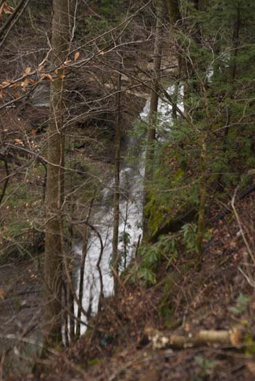
Up the creek you may find a nice shot or two. This road (CR 13) will take you over to Beckwith Rd. It's 6.8 miles of unpaved road and has been recently improved. Suitable for the average car.
If you are adventurous and want to see the falls up close, you will need to go on down the hill to the bottom at the bridge and turn right on Kanawha Falls Rd. (CR13-2) and drive out to the culvert under the tracks on your right. Not sure of any legal parking. We parked by a trailer roadside just up from the culvert. There's a red fire hydrant and room for one car on the side of the road without blocking the hydrant. That's about the only space there is without trespassing somewhere. The trailer was empty when I stopped there. Might be a summer place. Walk through the culvert and up the creek to the falls. It’s not that bad in low water and in high water you can turn left out of the culvert tunnel and hike up the creek on the left. Once you get to the top, it will be up to you to find your way to a good photo spot. There are several very large rocks and fallen trees to overcome to move upstream nearer the base of the falls, but there is a good flat spot in front of the falls. Not sure how accessible all this is in high water.
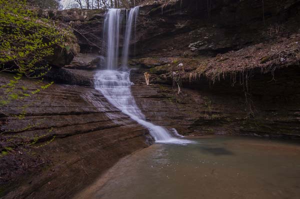
Fortunately, a lot of the trash that I saw from above on my first visit has washed down stream and the area at the falls is fairly nice. There is still a lot of trash in this gorge, but, fortunately none is in this view, especially the old washing machine that I once saw. Good luck here.


